CRETE
LASITHI
KOUPHONESI OR LEUKE
CRETE
LASITHI
KOUPHONESI OR LEUKE
The island of Leuke is mentioned by Pliny. A special mention is also made in the inscription known as the "Diaitesia (arbitration) of the Magnetes", built in the facade of the catholicon (main church) of the Toplou Monastery. The inscription refers to the conflict between Itanos and Ierapytna. Leuke was an important station of sponge collecting and mainly, of the working of murex shells, from which the famous, precious and expensive purple dye was extracted; moreover, its position was strategic mainly for the ships that stopped on the south-east coasts, and as a result became a reason of conflict between the two cities. Itanos was justified in the end.
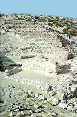
Leuke was continuously inhabited from the Early Minoan (3000-2200 B.C.) until the Early Christian period and was finally abandoned in the 4th century A.D. The very restricted human presence on the island thereafter (it was used only for cultivation and stock-breeding) greatly contributed to the preservation of the antiquities as it actually remained uninhabited, although the largest part of its surface was covered with sand.
The English admiral Th. Spratt was the first who visited the island in the middle of the 19th century and made detailed descriptions of the ancient remains he managed to locate: a temple in the south, with fragments of a marble statue, a settlement in the northern part of the island, and water cisterns in the centre. In 1903, the English archaeologists R.C. Bosanquet and Ct. Curelly conducted a survey to locate the ruins mentioned by Spratt, while in 1971 A. Leonard Jr. carried out a more thorough investigation. Systematic excavation started in 1976 by N. Papadakis of the 24th Ephorate of Prehistoric and Classical Antiquities and is still in progress.
The most important monuments of the area are:
The Theatre. At the north-east end of Kouphonesi, opposite the Marmara islet, and at a small distance from the beach, excavations have brought to light a well preserved stone-built theatre; the cavea had twelve rows of seats and a capacity of c. 1000 persons. Part of the cavea and the stone seats are not preserved today. The orchestra, almost semicircular in shape, was paved with clay slabs. The stage building (measuring 20 x 19 m.) is destroyed in the western part, but the eastern part, the paraskenion, the logeion, the hyposkenion and the east parodos, which had a tholos roof are preserved. It seems that the theatre was severely looted and destroyed by fanatic Christians in the 4th century A.D.
The Public Baths (Balineae). The second important building of the settlement was in use from the 1st until the 4th century A.D. This bath complex, a typical Roman edifice, includes all rooms which were in use in such a building: a garden (for the rest of the customers and visitors) around which are arranged rooms; the central space - with walls preserved to a height of 4 m. - two hypocausts, saunas and changing rooms.
The Settlement. It extends to the SE of the theatre. Very characteristic is a villa with eight rooms preserved; it has an imposing propylon, kitchens, and a domestic workshop for the working of murex shells. Two of its rooms have floors lined with black and white tesserae, forming geometric patterns.
The Temple. It lies in the southern part of the island, and measures 18 x 15.70 m. It is preserved to the height of the crepis, and has a central entrance on the narrow east side, and a second, stepped entrance on the north. The temple is largely destroyed as its stones were used as building material for the construction of the light-house. Two large pieces of a colossal cult statue (more than 2.5 m. high) representing an enthroned deity were found near the NW corner of the temple.
Cisterns. Very impressive are a series of spacious tholos cisterns which provided water carried from sources with built pipes.
Caves on the west coast. They have been used as chapels and preserve engraved representations of saints, and Latin inscriptions (one recording the year 1638).
|